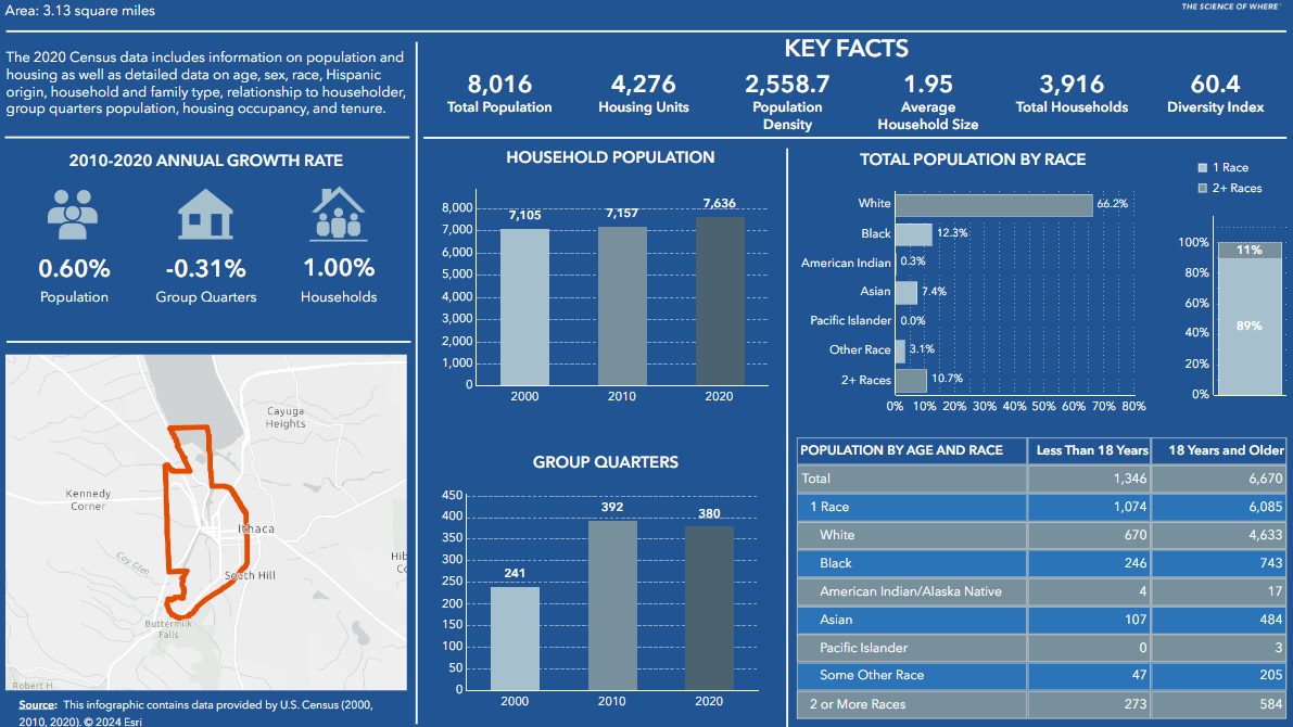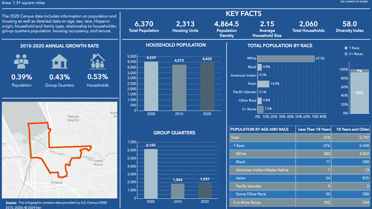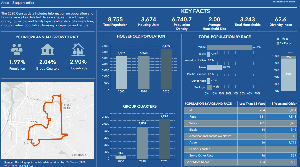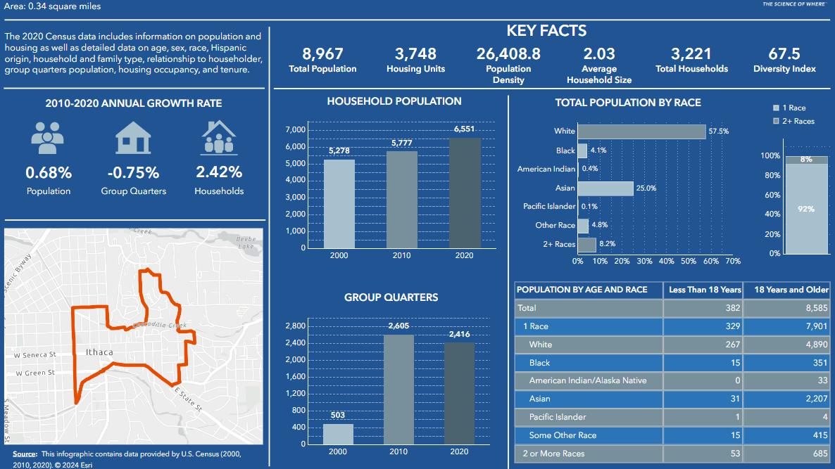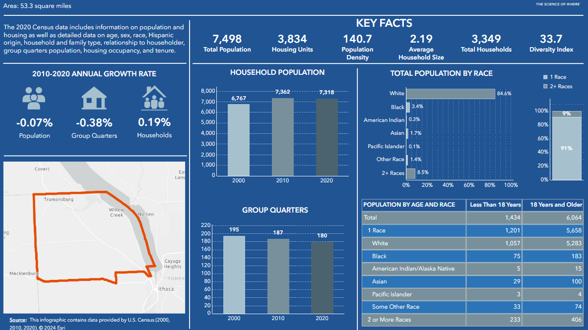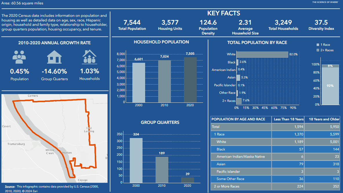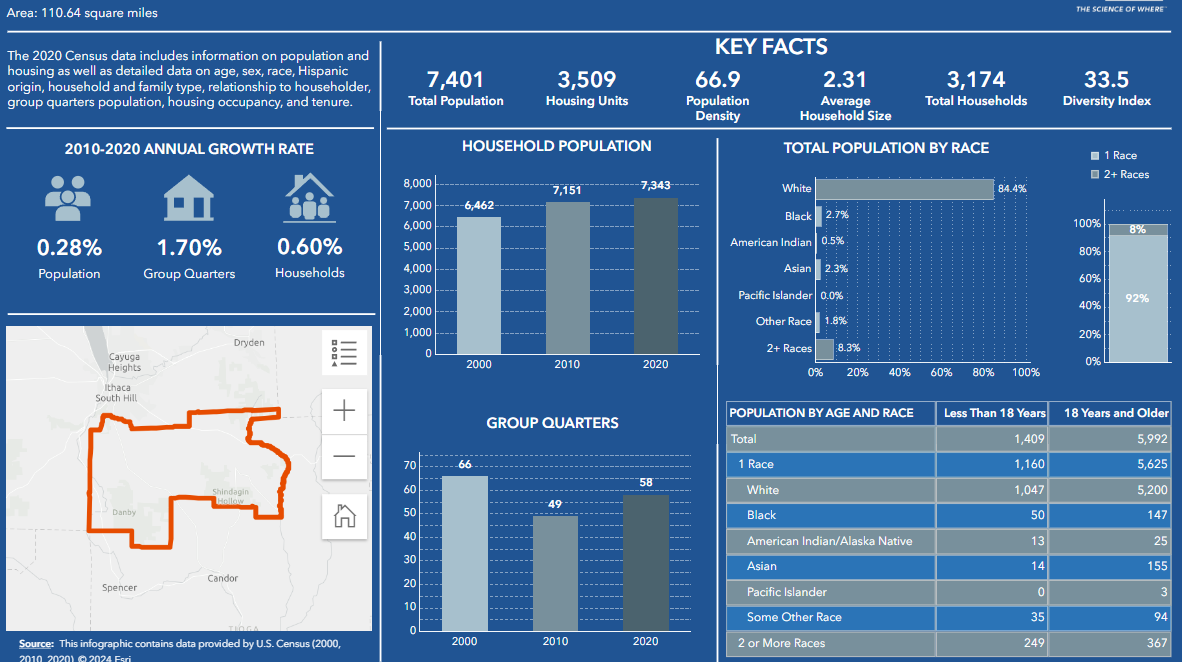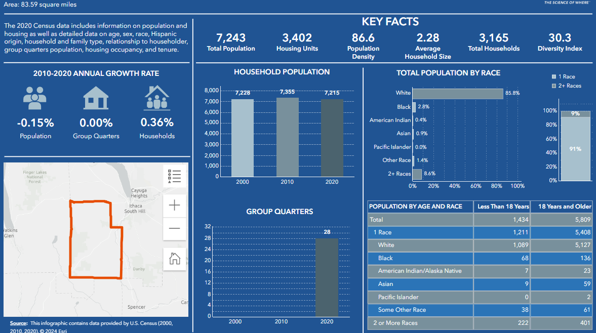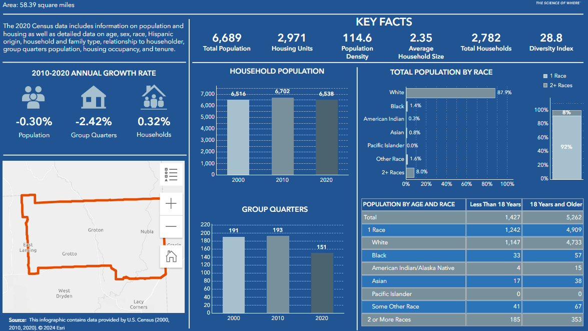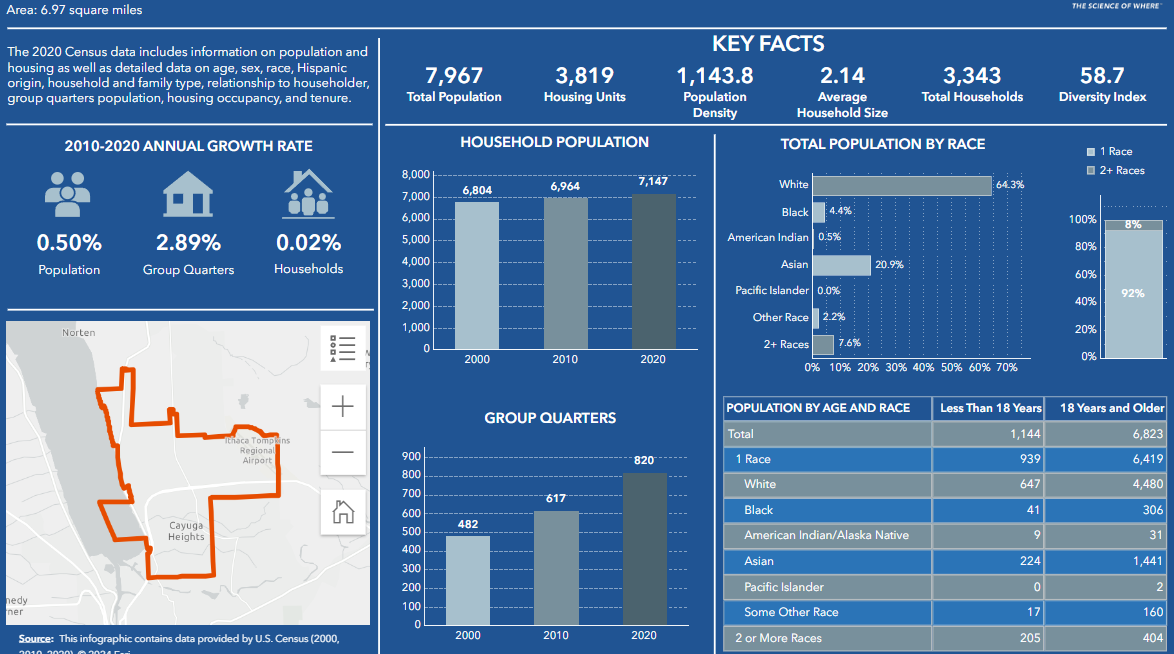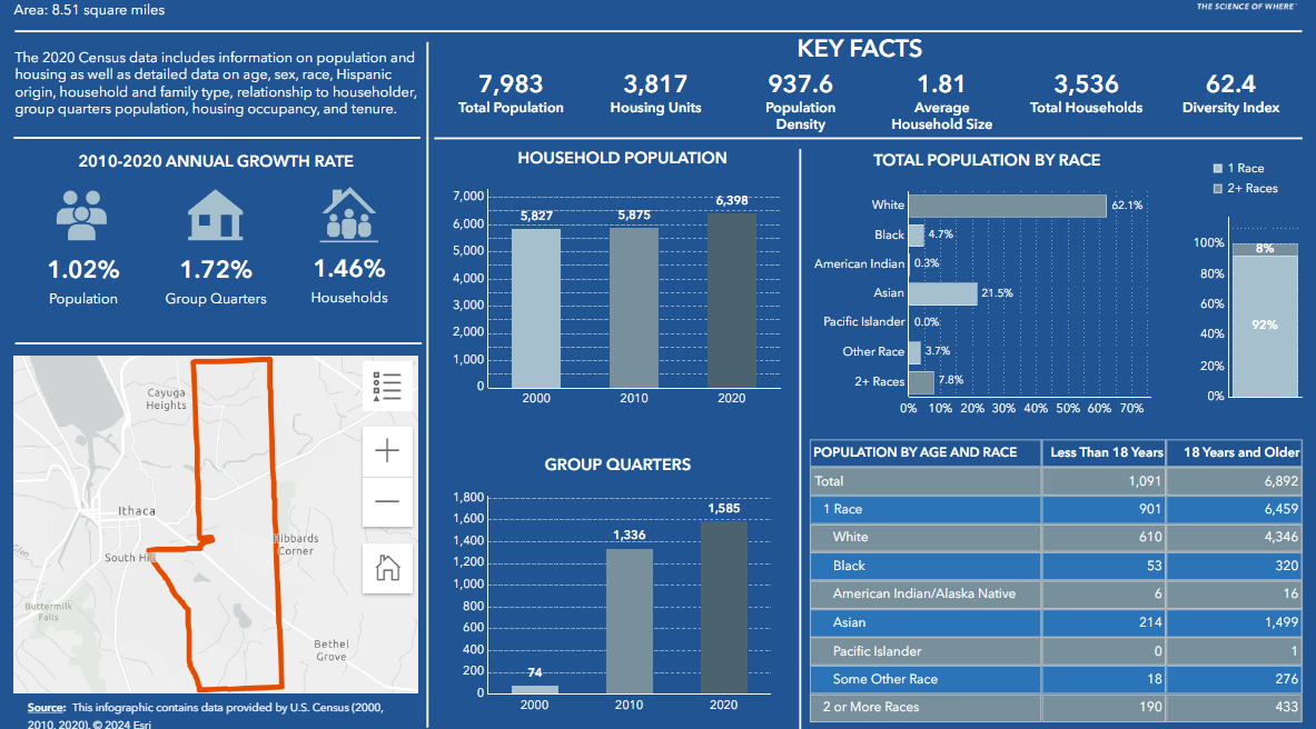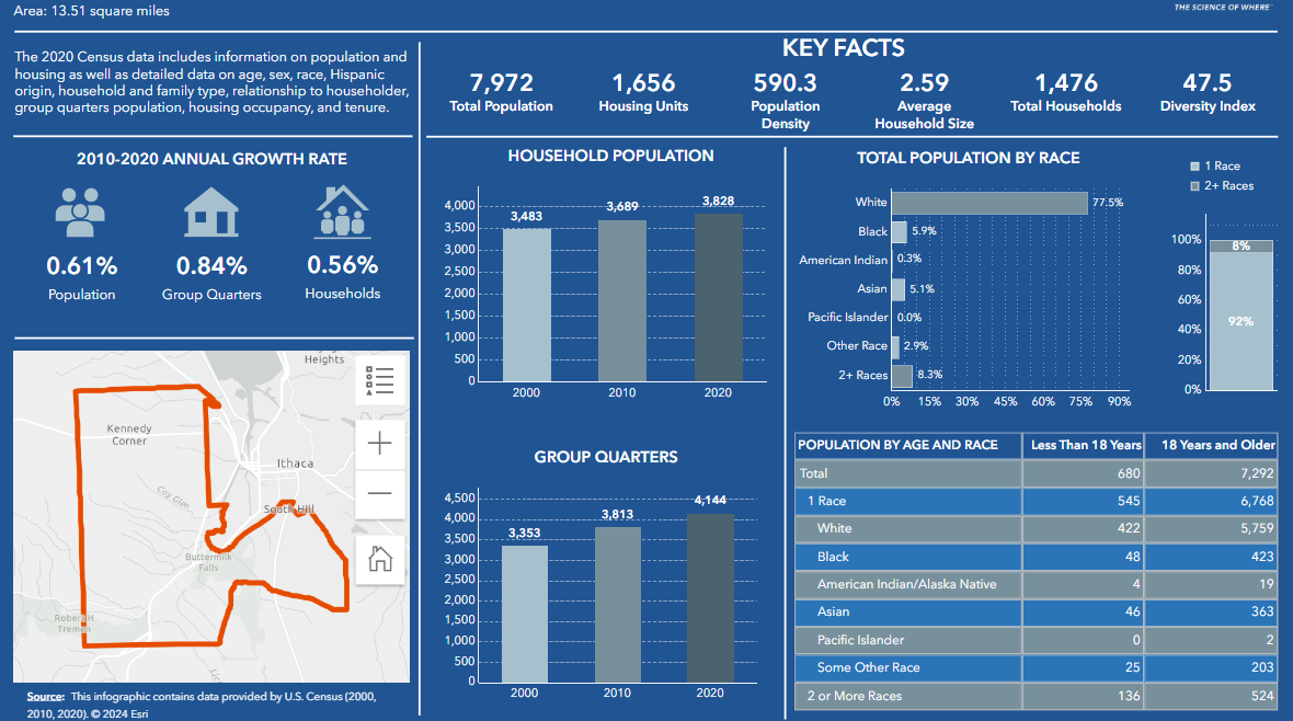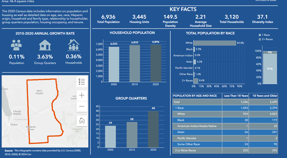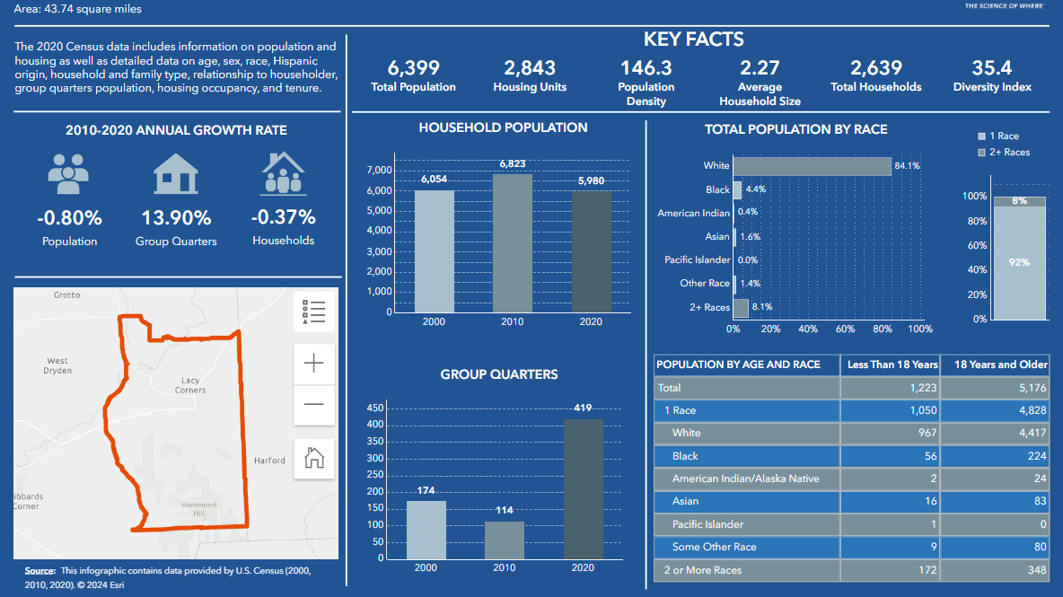
Tompkins County 2020 Census Profile - View Census info for Tompkins County and Municipalities here.
 For Redistricting Information See the Redistricting Site.
Downloadable data such as tracts, blocks, and block groups for the 2020 and 2010 Census can be found on the Tompkins County Open Data Portal
Census 2020 Summary Infographics
Click the images below to explore the data in more detail.
- Page 1: Summary - This page offers a quick overview of the population, demographics, and housing characteristics in your district.
- Page 2: Racial Data - Dive deeper into the racial and ethnic makeup of your district's population.
- Page 3: Housing Data - Explore information on housing units, occupancy rates, and types of housing in your district.
Below is a list of census-related maps based on the 2000 Census. For more info on the 2010 Census check here ![]() .
.
Old Census Data
- Census 2000 Urban Areas
- Census Tracts 2000
- Population Density 1990
- Population Density 2012 (an interactive app)
- American Community Survey Demographic Data from 2013-2017 Vintage (ESRI Living Atlas, Interactive)

